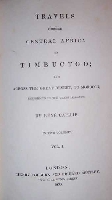
Travels Through Central Africa to Timbuctoo; and Across the Great Desert, to Morocco, Performed in the Years 1824-1828.
Year: 1830
Edition: First edition
Publisher: London, Colburn and Bentley
Category: Africa
2 Vols. All edges gilt. 8vo.
Vol. 1: 4, viii, 475, 4
Vol. 2: 4, xiv, 501, 4
Un livre trés important. M. Caillié était le premier Européen qui visitait Tombouctou, la ville que était pour l’Afrique ce que El Dorado était pour les Espagnols en Amerique: une ville magique, avec les rues pavé d'or, qui retournait à l'Europe.
Et bienque M. Caillié n’est pas si bien connu comme les grands explorateurs Anglais du XIXe siècle (Park, Burton, Speke, Livingstone, etc.), ce livre absolument est un livre le plus important parce que il a décrit toutes & tous ce qu‘il a trouvé pendant son voyage de découverte.
A detailed account of remarkable and dangerous travels in the search for and discovery of the city of Timbuctoo, by the first European to achieve this and to return alive. Although all expenses were borne by M. Caillié, the Geographical Society of Paris made a retrospective award of 10,000 francs. (Regarding the 1st French edition, published in 1830 prior to this edition, Gay [nr. 2748] writes: "Il reçut de la Société de géographie un prix de 10,000 francs, et publia avec Jomard, de l'institut, la relation de son voyage.")*
The journey (initiated near Freetown) was one of 4,500 miles and, before reaching Timbuctoo, M. Caillié a.o. visited the other important ancient city in Mali: Djenné, founded already about 300 B.C. Prior to this journey M. Caillié had learned Arabic and he travelled through these parts of Africa dressed as a Muslim, pretending to be Egyptian.
Caillié was the first white foreigner to reach the, highly tickling the imagination, but never seen by any European man before, city of Timbuctoo (Actually Alexander Gordon Laing was the first European to see Timbuctoo, however, he never returned to Europe as he was killed on his further journey). April 19th he reached Cabra, the port of Timbuctoo and on the 20th of April 1828, after a tiresome journey of one year and one day, he finally entered the city. Two weeks later he joined a caravan consisting of 800 camels “loaded with all sorts of merchandise from the interior” and left Timbuctoo on May 4th. In six days they arrived in el-Araouan where another 600 camels joined the caravan. May 18th they arrived at the wells of Télig from where they continued to el-Harib which they reached on June 29th. The 23rd of July they came to Tafilet and August 12th they reached Fez, where he stayed for a while and got the help of the French consul there, who arranged his voyage to Tangiers where he arrived on September 17th and from where he then sailed home. He collected an enormous amount of scientific data, both regarding geology and climatology, as well as anthropological data of all kinds, like the languages spoken, trade and crafts, customs and manners, etc.
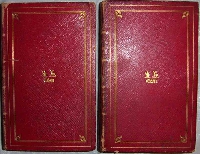
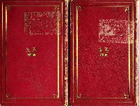
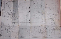
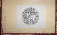
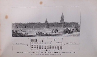
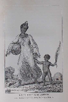
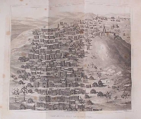
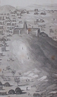
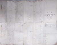
This set is in the original leather bindings, decorated with gilt and inner dentelles, of Charles Scott-Murray of Danesfield House (who died April 24th 1837) and has the bookplates of Charles Robert Scott-Murray of Danesfield, who has been a Member of Parliament for Buckinghamshire and later became High Sheriff of that county. Some scuffing and rubbing on covers, bindings are tight and strong, text is fine, minor spotting and foxing, some figures by pencil on inner frontboard of volume I. Some old tears in the maps, which have been expertly repaired with starch and Japanese paper, traces of a removed label on the backboards of each volume (see picture nr. 3), spines a bit soiled, name on ffep of both volumes. Plate of M. Caillié missing, all other plates, including the important plate of the Great Mosque of Timbuctoo, present as well as the 2 important maps. (This means 1 portrait of the author as a frontispiece, 4 plates, of which 1 folding, and 2 large folding maps. Also the copy of the Library of Congress has 4 plates and 2 maps. There are no traces of a removed plate, so most likely this 5th plate was never bound in.)
An appealing copy of this scarce book in an exceptional, contemporary binding.
Chadenat 5029, Hess & Coger 5426.
*) Edme-François Jomard is one of the founders of the 'Société de Géographie de Paris' (1821) and set up the 'Département des cartes et plans' in 1828. Amongst others he was the editor of this book, originally published (in 1830 as well) as: Journal d'un voyage ä Temboctou et à Jenné, dans l'Afrique centrale, précédé d'observations faites chez les Maures Braknas, les Nalous et d'autres peuples; pendant les années 1824, 1825, 1826, 1827, 1828 (Chadenat 537, Gay 2748, Prince Ibrahim-Hilmy I, p. 114, Joucla p. 48) and of both books by Frédéric Cailliaud: Voyage à l'oasis de Thèbes et dans les déserts situés à l'orient et à l'occident de la Thébaïde, fait pendant les années 1815, 1816, 1817 et 1818. and: Voyage à Meroe, au Fleuve Blanc, au-delà de Fazoql dans le Midi du Royaume de Sennar, à Syouah et dans cinq autres Oasis.
He was a member of the 1798 expedition to Egypt and drew the map of this country on 47 sheets.
Click on a picture to enlarge.

